Image source: topwar.ru
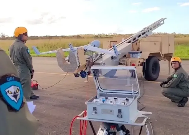
The Brazilian Navy has launched the ScanEagle unmanned aerial vehicle for the first time in its history. This is reported by the publication Defense Advancement. The publication emphasizes that the main function of the UAV during the first launch was to monitor the environment and assess the consequences of flooding in Rio Grande do Sul.
– the publication notes.
At the same time, it is emphasized that the ScanEagle drone flew over several flood-affected regions. All images taken during the flight were transferred to the headquarters of the Joint Command of the Flood Response Operation.
However, the Brazilian navy attaches no less importance to the very fact of launching the ScanEagle unmanned aerial vehicle than to the fact that with its help it will be possible to promptly help the victims.
– quotes Defense Advancement military personnel of the 1st squadron of unmanned aircraft.

Image source: topwar.ru
Military experts note that ScanEagle is capable of performing surveillance, reconnaissance and data collection tasks. Its maximum range is 54 nautical miles (approximately 100 km) from the base ship, it can work offline for up to 24 hours.
Experts consider the fact that this technology is not considered expensive to be an important point. The ScanEagle is equipped with an electro-optical camera with magnification up to 171 times. This means that when flying at an altitude of six hundred meters, the system is able to record the image of the vehicle's license plate.
Recall that Atlantico was originally created as a helicopter carrier. Then it was decided to reclassify it into a multi-purpose aircraft carrier.
