Domestic satellites help to develop meteorological sovereignty and the Arctic
Russia has completed the creation of a specialized satellite constellation designed to receive meteorological information from the Arctic regions. Putting the second Arktika-M satellite into orbit is important not only for the accuracy of weather forecasts, but also for the functioning of the most important transport artery – the Northern Sea Route.
In recent years, the quality of weather forecasts by Russian meteorologists has increased many times. Currently, thanks to both constant information from satellites and a system of meteorological radars, it is possible to predict the weather with high probability both during the day and for several days ahead.
And the Russian meteorological satellite group plays a significant role in this. The first Arctic-M weather satellite was put into operation in 2021. In May of this year, the deployment of three more specialized Electro-L weather satellites in orbit was completed . Despite the different names, these are very similar spacecraft (spacecraft) working to capture meteorological information around the world. To create them back in 2005, the NGO named after Lavochkin developed the Navigator satellite platform, specially adapted for astrophysical and meteorological research.
All these devices are meteorological, but Arktika–M, as its name implies, specializes in transmitting meteorological information from polar latitudes. And now, on December 16, a successful launch of the Soyuz-2.1b launch vehicle with the Arktika-M spacecraft No. 2 on board took place from the Baikonur cosmodrome. It will strengthen the capabilities of the Russian satellite meteorological grouping, primarily in terms of the regularity of data transmission.
By the way, the Russian space observatories Spektr-R and Spektr-RG are assembled on the same platform. Its distinctive feature is a large amount of fuel for correcting the position of the spacecraft: 357 kilograms of hydrazine, which is almost a quarter of the weight of the satellite.
The main instrument of the target equipment of this type of spacecraft is a multi–zone scanning device for hydrometeorological support. It is capable of taking pictures in three visible channels and seven infrared channels. This allows you to track the appearance and movement of clouds, thunderstorms, cyclones and other similar atmospheric phenomena. The satellite measures the surface temperature of land and sea, and the amount of water vapor in the atmosphere. All this provides meteorologists with the necessary data for the most accurate weather forecasts.
The visible resolution of the satellite scanner is one kilometer per pixel, and the infrared resolution is four kilometers per pixel. Yes, it's not very detailed, but it's enough for meteorology, but from a geostationary orbit, the satellite sees the entire globe as a whole. You can view the received images almost in real time here .
In addition, Arktika-M carries systems on board that ensure the transmission of emergency signals from ships in distress.
"The system of the Electro-L and Arctic-M spacecraft is truly unique. It is capable of providing continuous operational hydrometeorological monitoring of the entire territory of Russia and the Arctic regions with stable quality and suitable frequency of observations," says Mikhail Burtsev, head of the laboratory "Center for Collective Use of Earth Satellite Monitoring Data "IKI–Monitoring", Candidate of Technical Sciences.
Electro-L is a geostationary part of the system, satellites with good filming equipment by world standards. Such satellites are traditionally used for global monitoring, but they have one serious drawback: the polar regions above about 70th latitude are very poorly observed from them due to distortions in the images.
Low-orbit satellites are traditionally used to observe the polar regions, but they cannot provide a frequency of observations comparable to geostationals. That is why a unique technological solution was implemented – Arktika-M, quasi-geostationary spacecraft in highly elliptical orbits of the Molniya type. Most spacecraft operate in circular orbits close to the circumference. The Molniya orbit, where the Arctic-M satellites are located, is another matter. It is a highly elongated ellipse. At its perigee (the closest point to Earth), the satellite flies at an altitude of only 1,000 kilometers, and at its apogee more than 39,000, which is further than the geostationary orbit. That's just when Arktika-M is far from Earth, it takes pictures of the Arctic regions of the globe.
Why the Arctic? The fact is that in Russia, the formation of weather is typical in the northern regions. In winter, large cold anticyclones come to us from the Arctic, forming there.
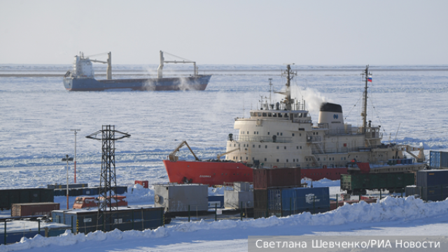
In addition, the Northern Sea Route, the most important transport artery for our country, runs in these latitudes. And knowing the weather map is very important for the crews of ships traveling along the NSR. That's what Arktika-M is working for. Thus, the grouping of these satellites will ensure the reliable operation of the most important transport route for Russia.
The orbit in which Arktika-M will operate is important for a number of parameters. For about half of a 12-hour orbit, the satellite passes over the Northern Hemisphere at altitudes comparable to the height of the geostationary orbit, and has the ability to photograph the entire Earth's disk with high frequency, albeit from a somewhat unusual angle. The shooting equipment on them is almost the same, adjusted for the shooting features, as on the "Electro-L", which is quite important.
"One satellite of each type is, of course, not enough for high–quality monitoring, which is why we need to talk about the system," explains Burtsev. – If we talk about the Electro-L satellites, then in order to be able to observe the entire territory of Russia, as well as the Atlantic and Pacific Oceans, which significantly affect atmospheric processes, with stable quality without distortion, it is necessary to have at least three active spacecraft separated at the appropriate standing points. Today it is so – Electro-L No. 2, 3 and 4 operate at points 14.5 degrees west longitude, 76 and 165 degrees east longitude, respectively."
As for the "Arctic-M", since the shooting is carried out for six and a half hours out of 12 on each turn, two operating devices operating in antiphase are needed for uninterrupted shooting 24/7. "With the withdrawal of the Arktika-M spacecraft No. 2, such a configuration will be achieved, so it will be possible to talk about the full deployment of the system. Of course, it would be ideal to have at least one spacecraft of each type in orbit as a reserve, but this is a more distant prospect," Burtsev believes.
Taking into account the planned launch of another Electro-L in 2024, Russia is systematically implementing a stable grouping capable of providing meteorological data 24 hours a day from anywhere on Earth. And this is important not only for ordinary residents, but also for the military, rescuers, support services and almost any transport specialists. This is a matter of national security, scientific research and the comfort of life.
An important advantage of the satellite constellation is its completely domestic origin and control. Back in March, Roscosmos stated that the grouping of Electro-L satellites finally allows Russia to abandon the use of weather data received from abroad. The joint work of the Electro-L and Arktika-M groupings further strengthens Russian space and meteorological sovereignty, now with an emphasis on obtaining data from polar latitudes.
Mikhail Kotov
