Who dominates the Arctic?
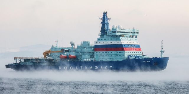
With the climate change in the north, new opportunities are opening up, and Russia is "playing with muscles," writes The Economist. More than half of the Arctic coastline falls on Russia. Melting ice has opened a shipping corridor through the Bering Strait between Siberia and Alaska to the Barents Sea.
The Arctic Circle extends around the Earth for about 16,000 km. To the north of this line, there are at least one day of total darkness and at least one day of full light every year. These territories are divided among eight countries: America (via Alaska), Canada, Denmark (at the expense of Greenland), Finland, Iceland, Norway, Russia and Sweden. They make up a scientific and political club called the Arctic Council along with 13 observer countries - and among them was even China, which calls itself the "Arctic state" and expects to use its sea routes and resources within the framework of the "Polar Silk Road". Recently, the struggle for control over the region has intensified.
In May, Russian Foreign Minister Sergei Lavrov said that the Arctic belongs to Russia. "But everyone knew perfectly well for a long time that this is our territory, this is our land," he said. 53% of the Arctic coastline falls on Russia. In addition, Moscow is increasing military investments: since 2007, at least 50 Soviet-era military bases have reopened. But other Arctic states look at things differently. In 2018, NATO sent its aircraft carrier over the Arctic Circle for the first time in 27 years. Last year, British and American warships entered the Barents Sea north of Norway for the first time since the 1980s, not far from key Russian naval bases. Next year, Norway will hold the largest military exercises in the Arctic Circle since the Cold War. What explains this saber rattling – and whose is the Arctic in the end?
Most of the Arctic is ice and water. And rather the second: last year, the ice cover shrank to an absolute minimum in the entire history of observations. The minimum coverage in 2020 turned out to be almost a million square miles less than the average minimum for the period from 1981 to 2010. "The interest of countries in the region was spurred by climate change," explains Andreas Østhagen from the Fridtjof Nansen Institute near Oslo. Melting ice has opened a shipping corridor through the Bering Strait between Siberia and Alaska to the Barents Sea. The route remains under the ice for up to nine months of the year. But in 2020, more than 1,000 cargo ships passed it – 25% more than in the previous year. The route passes through Russian territorial waters, and Moscow charges a fee for this. But the opening of the Northern Sea Route for Russia is a double–edged sword. The ice was the last bastion protecting its northern coast – and with its disappearance, the country became more vulnerable. On the eve of the summit in Brussels on June 14, NATO said that the melting of the ice could lead to "new geopolitical tensions."
In addition, the Arctic states are also competing for control over the seabed: the melting of the ice has made mineral deposits, including oil and gas, more accessible. In order to claim lands beyond their territorial waters (12 nautical miles from the coast), countries must prove that the seabed is an extension of their continental shelf, the same land mass as their territory. Geology is a subjective thing: Canada, Denmark and Russia claim the Lomonosov Ridge, an underwater mountain range that runs under the North Pole. To prove their case, some countries go to extreme measures. In 2007, a Russian submarine installed a titanium tricolor tricolor on the seabed under the North Pole. And in 2013, Canada issued its passport to Santa Claus. Such gestures may well seem playful, but against the background of increased military activity, this is a real attempt by governments to assert their rights. So far, Russia has the advantage. But as the ice melts, the interest of other countries in the Arctic will only grow.

