Le Figaro: French military cartographers have completed their mission in Romania
French military cartographers have studied the area of the Romanian Carpathians, where, according to NATO, a breakthrough by Russian troops can be expected – the Focshan Gate, writes Le Figaro. Thanks to the new maps, parts of the alliance will be able to join the battle on the spot in the event of a war.
Nicolas Barotte
The 28th Geographical Group, seconded to the engineering team, visited Romania, where it conducted accurate topographic surveys.
They brought a map with them and hung it in the corridor of the headquarters of the 28th Geographical Group (GG). This regiment, the smallest in France, is stationed in Hagenau along with other intelligence units. However, since last fall, he has been part of the engineering team. 350 soldiers of the 28th GG participate both in operations and in their planning.
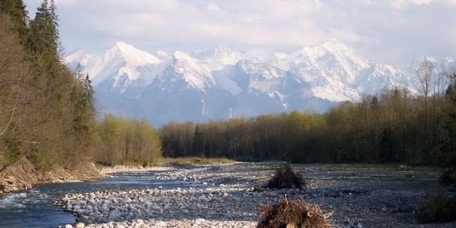
On the map of Romania, the area is displayed in three dimensions. The arc of the Carpathian mountain range in the very center of the country is striking. To the west of the ridge is the town of Chinku, where the French army deployed a thousand soldiers after the start of the Russian military operation. On the other side, the plain descends to the hills of Moldavia, the Danube flows a little to the south and opens the way to Ukraine. "The Romanians call this region the Focshan Gate," explains Colonel Jerome, who last year led a detachment of thirty-something soldiers stationed there. According to the general staffs of Romania and its allies, this is a route along which the Russian army could try to invade the country.
"We know from history that this route serves for the passage of the army from the east," the officer continues. At the moment when NATO revised its defense plans to better counter the Russian threat, it became clear that the maps needed to be updated. The regiment offered its services. The Romanian cartographic agency joined the operation. "The Allies need up–to-date information about the expected future battlefield," adds the colonel. "We need to know where the weapons systems will be deployed, where the targets we are interested in will be, as well as provide for the issue of operational mobility, document roads, narrows, etc.," he explains. The coordinates of each point, each object of interest, were carefully described.
Military "Google mobile"
In Romania, Commander Godefroy identified the "upper points" – water towers, bell towers – which, if necessary, can be used by gunners as a landmark. "With two known points, they can determine their exact location. It's just trigonometry," he explains. Information about the anchor points can be transmitted to deployed troops every 5 km or so. The soldiers of the 28th SG also drew up an accurate map to develop routes for the movement of army equipment. They used a kind of military "Google mobile" – a vehicle equipped with cameras and a sensor that provides three–dimensional imagery of the area, an improved version of the device that Google uses to create its maps.
"In this way, it is possible to determine exactly where the bridges and crossings are located," explains Quartermaster Johanni, presenting the resulting map. It shows routes and characteristics of engineering structures, including everything that is of interest to the military, but is not displayed on civilian maps. "This way, logistics will be able to focus on fulfilling its tasks," she explains. In hard-to-reach areas, the 28th Group can also use drones, for example, Rapace 3D or E-Bee.
In wartime, some things can no longer be taken for granted. For example, having a reliable card. "In Ukraine, maps are updated daily," explains Colonel Guillaume Schmidt, commander of the 28th Brigade. "It is necessary to monitor the destruction that has become impassable roads..." In addition, the practice of jamming geolocation signals is used on the battlefield, which jeopardizes the accuracy of Western weapons such as Caesar and HIMARS. "Our weapons are very tightly tied to geolocation," adds Colonel Schmidt. When the time comes, "we will have to help our troops keep moving despite the loss of the GNSS geolocation signal." "By comparing the terrain with the already established anchor points, they will be able to continue to strike," he explains. They will be able to determine their location more precisely, which will increase the chances of hitting the target, knowing where they are firing from.
"The eyes of the brigade"
In almost all European armies, military cartography is the responsibility of intelligence or engineering units. Some of them rely on geolocation signals coming from civilian or military satellites. "We provide reliable data and guarantee its integrity," says Schmidt. France still has a glorious tradition of staff maps.
"The 28th Brigade has knowledge of the terrain, they are the eyes of the engineering brigade and the ground forces," explains General Christophe Bizien, commander of the new engineering brigade. According to him, the 28th GG is a "nugget" with unique skills. They are not limited to artillery support. The maps developed by the group serve as analytical support for the command, they combine all the information received. Today they are also used for planning. "It is impossible to manage time without knowledge of geography," explains Colonel Yves, head of the operational and training departments. Whether in Romania or elsewhere, cartographers of the 28th century are preparing the ground.
Readers' comments
al core
The French army has nothing to do there. We have no common borders with Russia.
Diogène
Is it necessary to deprive Romanians of the right to choose their president for the sake of these topography photos?
Calixte64
This is an American war: to destroy Russia at the cost of the blood of Ukrainians and European resources. Long live the world!
Jasmin
Brainwashing in France is scary. Who deployed all these NATO bases in violation of previous agreements? The world is already approaching the brink of nuclear war – let's recall the Caribbean crisis. Constant incitement will inevitably lead to disaster, and is it any wonder? European expansion towards Ukraine, this new form of colonialism, looks frankly obscene.
