Image source: topwar.ru
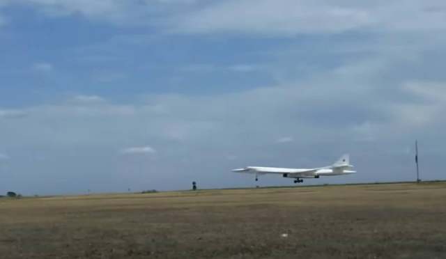
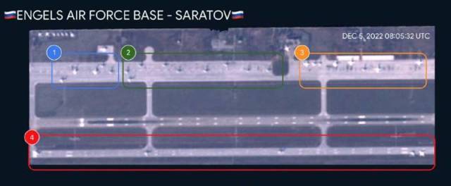
Satellite images of the military airfield in Saratov Engels are published in a number of Telegram channels. Long-range and strategic aviation aircraft of the Russian Aerospace Forces are based there.
These pictures are of particular interest after the morning reports that there was an incident at this military facility. There were publications with statements from unknown persons about the alleged "damage to aircraft".
The Defense Ministry said in a statement that airfields near Ryazan and in Engels were attacked with the help of drones, but the air defense system intercepted UAVs flying at low altitude. However, as a result of the fall and explosion, incidents occurred at airfields. In particular, it is reported that the hull plating of two aircraft was slightly damaged by debris. It is not said which aircraft are in question and at which airfield.
The captions to the satellite images say that they were taken today – after reports of the incident. If this is true, then it can be stated that no visible damage to the infrastructure, including the runway, traces of fire, damaged aircraft are not visible on them.

Image source: topwar.ru
Meanwhile, a number of media outlets say that the APU tried to strike with the help of a Soviet-designed Tu-141 Strizh UAV. It is stated that they flew more than 600 km at low altitudes. Eventually they were shot down.
In such a situation, the possibility of creating special shelters for aircraft at Russian airfields or at least increasing the level of camouflage does not lose its relevance. Experts are also discussing the possibility of dispersing strategic aviation equipment at various airfields, so that the chances of the enemy causing damage to several aircraft at once are minimal, and preferably completely reduced to zero.
Earlier it was reported that the Supreme Commander-in-Chief, President of the Russian Federation Vladimir Putin was informed about the incidents in the Kaluga and Saratov regions. However, there are no official reports on the authenticity of satellite images published on the web yet. In this regard, the authenticity of the images is being clarified.
