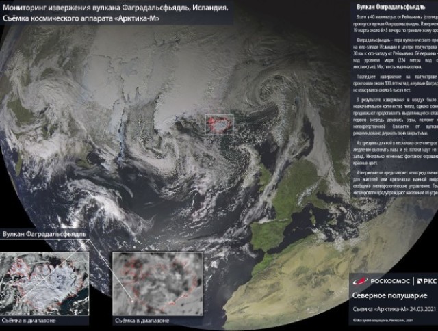
During flight tests of the new Russian remote sensing spacecraft "Arktika-M", scientists of the holding company "Russian Space Systems" (RKS, part of the State Corporation "Roscosmos") tested the possibility and confirmed the effectiveness of using the target equipment of the satellite for operational monitoring of volcanic activity, the press service of the RKS reported.
The integrated use of different types of remote sensing data and technologies for their interpretation together with the data of geological and geophysical studies allows optimizing the actions of emergency services to minimize the possible consequences of volcanic eruptions and the spread of ash plumes, coordinating the work of environmental organizations and communities, as well as raising research in the field of volcanology to a qualitatively new level.
The MSU-GSM satellite scanner developed at the RCC conducted a multispectral survey and provided initial data for analyzing the activity of two volcanoes – Etna in Italy and Fagradalsfjadl in Iceland.
"All active volcanoes of the northern hemisphere of the Earth fall into the field of "digital vision" of the target equipment of the Arktika-M spacecraft. The spectral and geometric characteristics of the MSU-GSM allow us to detect such objects from space – the high sensitivity of the equipment allows us to detect and evaluate thermal anomalies, track the dynamics of volcanogenic processes and the energy characteristics of transient eruptions, despite the small size of the "hot" zone of the volcano," said the head of the Scientific Center for Operational Monitoring of the Earth RCS Andrey Emelyanov.
The results of remote sensing of the Fagradalsfjadl volcano 40 km from Reykjavik – the capital of Iceland-confirmed the ability of the target equipment to conduct a multi-factor analysis of the spectral characteristics of the object of observation. The data obtained allowed us to estimate the volume of ash emissions as safe for the health of residents of the surrounding areas. At the same time, the equipment recorded in real time the increased content of emissions in the atmosphere, which continued to spread for several hours.
The Etna eruption survey data demonstrated the high temperature sensitivity of the 3.5–4.1 microns spectral channel of the target equipment for observing high-temperature radiation sources on the Earth's surface. During the eruption of the volcano, the satellite recorded its thermal activity. At its own spatial resolution of 4 km, the MSU-GSM scanner observed thermal processes in the hot crater of the volcano, which is only a few hundred meters in size.
The Arctic-M hydrometeorological spacecraft was launched on February 28, 2021, and is currently undergoing flight tests. The satellite is designed to provide round-the-clock monitoring of the Earth's surface and the seas of the Arctic Ocean. The use of remote sensing data from the Arktika-M spacecraft will contribute to the socio-economic development of the northern regions of Russia.

