the company from the united states began to provide commercial services for radar survey of the earth's surface from space in a resolution of 50x50 centimeters per pixel. This is the best indicator available on the market, and the images themselves are formed in such a way that even a layman can work with them.
Startup Capella Space from California offers everyone to order a survey of any part of the earth's surface. Some areas of the planet, of course, are available in lower resolution due to the peculiarities of the orbit, but this drawback will be corrected. Very soon, six more satellites will be launched into space, and the next launch will take place this month.
Shooting the earth's surface in near-real time and high resolution is important for many structures-both commercial and government. Among other things, the company hopes that their orbital grouping will help save lives during natural disasters, as well as perform operational monitoring of infrastructure facilities. In other words, the scope of applications is quite wide.
The Port of Shanghai handled a record breaking 4.2 Million containers throughout October. We used #SAR imagery to gain a timely and precise view into the change in cargo and vessel activity. #port #monitoring pic.twitter.com/3UmyhwR9re- Capella Space (@capellaspace) November 10, 2020
the images that the company's clients receive are monochrome. They are created by the method of radar synthesis of the aperture (synthetic-aperture radar, SAR) of the centimeter range (X-band). therefore, images can be obtained regardless of the time of day and weather conditions. and most importantly, it is theoretically possible to see even what is happening behind some barriers to visible light. for example, under fabric awnings, tents or thin plastic or wooden coverings.
Previously, the satellite image market was dominated by providers of optical images in various ranges. However, they have several significant and obvious drawbacks-dependence on weather conditions and illumination of the planet's surface. Radar remote sensing of the Earth usually requires qualified specialists to decipher the images. This is due to the resolution and features of radar operation. Therefore, until recently, SAR-sensing of the Earth was not widely available to commercial customers and was ordered mainly by government contractors and scientific institutions.
In particular, getting detail at less than 50 centimeters per pixel is not a problem for modern satellite radars. However, this will be the resolution of only one of the axes, which means that the pixel is not square. On the second axis, the resolution is often a whole meter (for example, 100x25 centimeters — one of the best results on the market now). To this are added various features of the reflection of radio waves from different objects. As a result, the picture for an untrained person may look completely incomprehensible.
The know-how of CAPELLA space just consists In the final processing of images. For clients, they are formed as if they are optical images. differences in brightness due to the characteristics of the materials of the observed structures and other nuances are normalized. it turns out a frame that is as similar as possible to a" normal " satellite image, but which shows more details than usual. of course, if desired (probably for a fee), the client can also provide "raw" data.
")
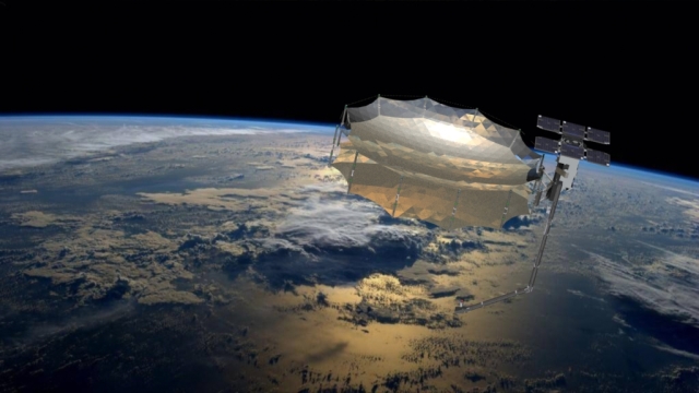
Artistic representation of the Denali microsatellite (Capella-1)
Image Source: Capella Space
Currently, there is only one operational satellite in the Capella orbital constellation, numbered two and codenamed Sequoia. It was launched on August 31, 2020 into a sun-synchronous orbit with a height of 550x536 kilometers using a Rocketlab Electron rocket. Before that, in 2018, the California-based company also launched a Denali prototype. The most amazing thing is the size of these devices.
Capella Space satellites are strikingly different from all previously used SARdevices that work with high-resolution images. They belong to the class of cubesats and weigh about 100 kilograms. In the transport position, their dimensions do not exceed the size of a washing machine, and in orbit they lay out antennas for several meters around. According to the description on the official website of the company, its satellites are a real work of engineering art. Sequoia (Capella-2) has more than 100 separate electronic boards, 400 meters of wires, and the source code of the software exceeds 250 thousand lines in C, 10 thousand in Python, and another half a million lines of instructions for programmable controllers (FPGAs).

In the Spotlight Mode, which provides the maximum image resolution, the satellite scans the observation area with radar from several angles for 20-60 seconds while flying over it in orbit
Image Source: Capella Space
At the same time, the real resolution of images before processing is amazing — 5-10 centimeters per pixel. To get the final image without noise and distortion, you need several such frames, the principle of image construction is called InSAR. Such impressive results were achieved thanks to the satellite's ability to keep the observed area in view for about a minute. this mode of operation even has the brand name spotlight mode — for its implementation, sequoia is rejected entirely.
Interestingly, the resolution of 50x50 centimeters per pixel is the image quality for commercial customers, limited by American law. for government agencies, capella can also provide twice as clear images (25x25 centimeters per pixel). the head of the startup,payam banazadeh, hopes that the regulatory authorities will lift the restrictions in the near future.
we can not say that capella space has no competitors, even with such impressive product characteristics. back in the spring, iceye said that its 100-kilogram satellites showed the ability to make sarimages with a resolution of 10x10 centimeters per pixel. however, these devices have not yet entered commercial operation.
