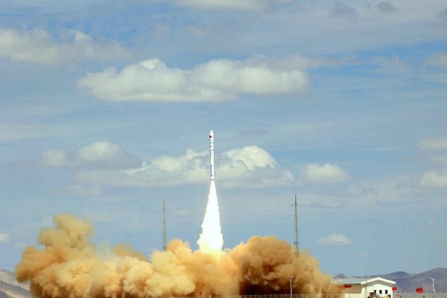
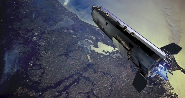
Over the next three years, China will launch three hundred microsatellites into ultra-low Earth orbit. They will be equipped with high-resolution cameras and equipment for pre-processing information. The first test vehicle of the new grouping is already ready, its launch is scheduled for December 2023.
According to the SpaceNews portal, such plans were announced by representatives of the Chinese Aerospace Scientific and Industrial Corporation (CASIC) at the recently held forum of commercial aerospace organizations in Wuhan. The roadmap of the project implies 192 satellites in the grouping by 2027 and 300 by 2030.
In the coming December, a test device will be launched to test the basic concepts and technical solutions on which the success of the entire constellation will depend. As a payload, the satellite carries a high-resolution camera, an on-board computer for primary analysis of the received data and an atomic oxygen detector. The working orbit is near—circular, the altitude is not specified, it is indicated "in the range of 150-300 kilometers".
The tasks of the new grouping are reduced to operational observation of the Earth's surface for commercial and humanitarian purposes — the client will be able to get up-to-date images of the area of interest within half an hour after ordering. This should be especially useful in emergency situations, the developers of the device told the Global Times online edition.
The ultra—low Earth orbit ( VLEO ) is the stable trajectories of satellites close to circular with a maximum height of up to 400 kilometers at apogee. China is not a pioneer in the development of VLEO, but is at the forefront of a new round of interest in this area of near space. Several countries, including the USA and EU states, have announced their projects to create devices for VLEO. However, apart from the Celestial Empire, no one has yet indicated even the timing of the deployment of groups, not to mention the specific launch dates.
The attractiveness of VLEO for Earth remote sensing satellites is due to the smaller distance to the surface. To get a picture in the visible range with a resolution of about 50 centimeters per pixel, cameras and optics weighing half as much as for devices operating at altitudes of 500 kilometers are enough. For synthetic aperture radars, the reduction in size and the cost of equipment is smaller — the savings will be 40 percent.
Naturally, nothing is free: at altitudes up to 400 kilometers, the influence of the atmosphere is still great and poorly predictable. This means that VLEO-powered vehicles must have sufficient energy and working fluid reserves to maintain the orbit. And even in this case, their service life will be short. The developers of the new constellation at CASIC promised that this shortcoming would be compensated by mass production of satellites. Thanks to this, they will turn out to be cheap, and you can run them often. Apparently, on commercial and inexpensive rockets.
Despite the recent revival of interest in ultra-low Earth orbit and the peculiar fashion for the term VLEO in cosmonautics, there is nothing radically new in this concept. Reconnaissance satellites have been working there (and have been working there) since the early 1960s. The American CORONA program lasted until 1972, the devices of the eight series functioned their entire service life or part of it in orbits with heights from 180 to 380 kilometers. Later, the baton was picked up by the USSR, which had been launching satellites of the US-A series since 1971 (the ones with nuclear reactors on board).
What distinguishes the modern trend for the development of VLEO is the commercialization and mass character of the devices used. If each satellite costs five times cheaper than the one intended for the "average" LEO (400-900 kilometers), then let it work for a year instead of three to five. The lower the target orbit, the more mass can be delivered to it — so there is also savings on launch services. Consequently, one rocket outputs much more and so lighter VLEO satellites.


