The Electron rocket will deliver a new generation of Acadia satellites into space. These devices will be able to receive images in conditions in which optical cameras are powerless: at night, during clouds, snow and rain.
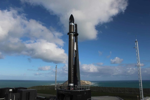
The private aerospace company Rocket Lab has scheduled for July 28 the next launch of its ultralight two-stage carrier rocket "Electron". The first of four new-generation Earth remote sensing satellites, Acadia, developed by the American aerospace company Capella Space, will be sent into low-Earth orbit. The rocket will be launched from the Rocket Lab Launch Complex 1, which is located on the Mahia Peninsula in New Zealand.
In recent years, more and more private companies and government organizations are trying to use Earth remote sensing satellites in their work. These devices make life much easier for meteorologists and forestry services, because they are designed to monitor the surface of our planet, can explore vast territories in real time.
With the help of such devices, natural resources, land, oceans, forests are monitored. Also, these satellites are used to collect geodetic data — for example, they track the movements of submarines, perturbations of the Earth's gravitational field. Recall that it was such satellites that made it possible to find out that global greening has been going on on the planet since 1980 — the process of a significant (by tens of percent) increase in biomass and a noticeable increase in the total area of leaves.
As of 2022, 1,052 such satellites were collecting data in low Earth orbit. The vast majority of them are devices that observe the Earth in the visible range, that is, their cameras work with visible optical radiation. However, such systems have a number of disadvantages: they cannot fully shoot at night, in rain and snow, "look" through clouds and fog.
Satellites observing the Earth in the visible range are not the only way to get images of the surface of our planet. Recently, European and American companies have been developing devices that allow receiving data in a completely different way — using radar aperture synthesis .
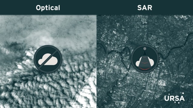 |
| Comparison of satellite images. On the left, the image was obtained in the visible range, on the right, an image constructed by a satellite with radar aperture synthesis. |
| Source: ©Ursa Space |
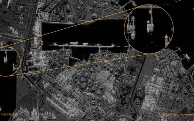
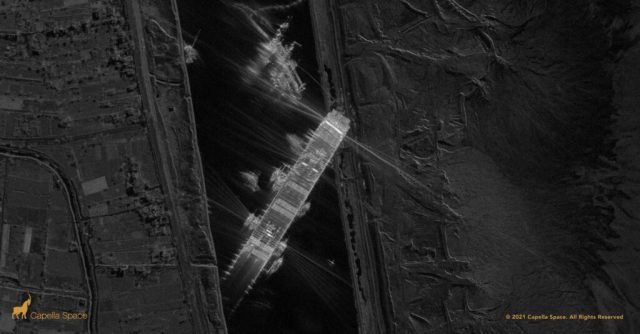
These new satellites do not use sunlight, which is necessary to obtain optical images. Instead, they direct radar waves to the surface of the Earth, and then register the reflected signal, on the basis of which they build a full-fledged image of the area they are studying. Electromagnetic waves of the radio range penetrate through clouds and therefore allow you to receive information about what is happening on the surface at any time of the day and in any weather.
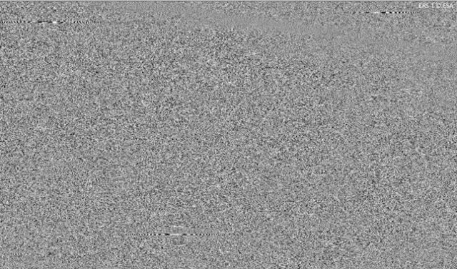 |
| This is how the initial data from a satellite with radar synthesis of the aperture looks like. |
| Source: ESA[/media-desc |
Among the companies developing satellites with radar aperture synthesis, the leading position is occupied by the American startup Capella Space. Its most recent development is the third—generation Acadia satellite. This device will be able to build images with a high spatial resolution of up to 31 centimeters, and the satellites of the previous generation Capella-2 could build images with a spatial resolution of 50 centimeters. Acadia will allow you to display more details on images, provide the highest quality, the best resolution and the maximum data transfer rate.
The deployment of such types of satellites in some cases gives serious practical advantages. Today, military spy satellites are powerless in cloudy conditions, and at night they have a very moderate resolution (that is, low detail). This makes it possible to prepare and conduct even large operations or the outbreak of war relatively suddenly. Conventional satellites with radars "see" through clouds, but their resolution is much lower than those observed in the visible range. The resolution obtained by the satellite with radar synthesis of the aperture allows both to "see" in cloudy or night conditions, and to obtain highly detailed images at the same time.
In total, Rocket Lab will launch four Acadia satellites into low Earth orbit. All four launches of the Electron rocket are scheduled from the Rocket Lab Launch Complex 1, they should be held before the end of 2023. The upcoming launch will be the 40th anniversary for Rocket Lab.
