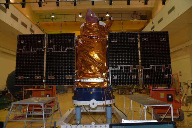
The dangerous approach of the spacecraft occurred, according to Roscosmos, at 04: 49 (Moscow time) on November 27. The minimum distance between the two remote sensing satellites — the Russian "Canopus-B" and the Indian Cartosat-2F — was only 224 meters.
The announcement of the rendezvous was published on the official website of the state Corporation for space activities Roscosmos. Monitoring the position of satellites and determining the distance between them was performed by the Main information and analytical center of the automated warning system for dangerous situations in near-earth space (Giac ASPOS OKP) TsNIIMash. Additional details are not reported, what was the probability of a collision and whether any maneuvers were taken to change the trajectory of the vehicles is unknown.
According to open trackers of near-earth objects ( Celestrak, Heavens-Above ), the orbits of the satellites met at an altitude of about 600 kilometers above Antarctica. Their speed relative to each other exceeded 14 kilometers per second. Given the mass of the vehicles — 710 kilograms for Cartosat-2F and about 460 kilograms for Canopus-B-the collision could lead not only to the appearance of a large number of fragments, but also to the scattering of this debris in different orbits. In any case, 224 meters is a very small distance by the standards of space.

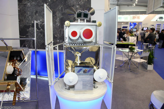
Model of the Canopus-V satellite at the MAKS-2003 exhibition. A total of 6 devices of this series were launched, all of them are active. Which one almost collided with the Indian "brother" is not specified. Judging by the known trajectories — the third, but the time of crossing the orbits does not coincide with the data of Roscosmos. The data may not be accurate in open sources
Image source: Wikipedia, Vitaly V. Kuzmin
Despite a lot of speculation, a real collision in earth orbit has only occurred once so far: in 2009, the Russian Kosmos 2251 crashed into the American Iridium-33. The first was a decommissioned military communications satellite, and the second was an active element of the iridium satellite operator's orbital constellation. The trajectories of the vehicles intersected at an altitude of about 790 kilometers above Taimyr at a relative speed of 11.7 kilometers per second. The collision produced more than 600 fragments measuring more than five centimeters across and several thousand smaller ones.
Tracking systems for all objects in orbit are an essential element of the rocket and space infrastructure. With the increasing number of artificial satellites, their role will only increase. Even the young orbital group SpaceX managed to mark a relatively dangerous incident. In the fall of 2019, due to a software error in the collision risk warning system, the Starlink operator did not receive a clarifying warning and did not initiate a trajectory change maneuver. The European satellite Aeolus had to "Dodge". And although the risk of a collision was small, the incident had a great resonance.

