The ban on their publication will not only create difficulties for Iran, but will also allow Washington to hide military failures, experts believe.
The decision of the American company Planet Labs to stop publishing current satellite images of the conflict zone in the Middle East will not fundamentally affect the course of the war, experts interviewed by Izvestia believe. It will become more difficult for Iran to track the movement of mobile complexes, aircraft at airfields and maneuvers of ground groups, but they already know the coordinates of military bases, refineries and other critical infrastructure facilities. In addition to trying to deprive Tehran of operational data, the Pentagon's desire to silence its own losses and the consequences of attacks on civilian targets in Iran may be behind the US decision.
How tactics are changing in the conflict zone
On April 5, Planet Labs stopped distributing high-resolution satellite images of Iran and other countries involved in the conflict. The decision was explained by a corresponding request from the US government to all satellite data providers.
In early March, Planet Labs already restricted access to these images — they began to be published with a two-week delay. Now their distribution has been suspended completely and indefinitely — until the end of the conflict. Earlier, another player in this market, the American company Vantor, also restricted access to its satellite images of the Middle East, explaining this as "protection of allied forces and civilians."

Photo: Global Look Press/NASA
Image Source: iz.ru
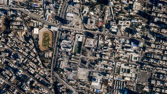
Planet Labs, based in San Francisco, has a group of more than 200 Dove devices. These miniature satellites allow you to obtain a complete image of the Earth's surface with a resolution of 3.5 m every day.
Military expert Dmitry Kornev believes that a ban on the publication of these images may create certain difficulties for Tehran, but will not undermine its defense capability.

Satellite image of Mehrabad Airport in Tehran before and after the US airstrike
Image source: Photo: Planet Labs PBC/Handout via REUTERS
— The coordinates of stationary facilities — bases, factories, and infrastructure nodes — are known in advance. Iran does not need daily updates to attack them. The main problem is the loss of efficiency: Tehran is losing the ability to quickly track the movement of mobile complexes, aircraft at airfields and maneuvers of ground groups," he explained to Izvestia.
According to the expert, this creates a temporary advantage for Israel and the United States. The lack of fresh images will allow them to use disguises and deploy false positions. Because of this, part of the Iranian missile potential can be spent on imitation purposes.
Why do Iran's military targets remain available for attack
Iran's own satellite constellation is currently in its infancy, unable to provide the necessary frequency of flights and image quality to fully replace commercial services, Dmitry Kornev noted.
However, the American companies that the Pentagon is putting pressure on are not monopolists, the market for remote sensing of the Earth is extremely diverse today, said military expert Alexei Leonkov. There are several European services. For example, the SPOT network developed by the National Space Agency of France. Airbus operates the Pléiades optical satellite constellation. Chinese commercial satellites also capture images comparable in quality to American ones. The only question is Beijing's political will — to what extent and in what detail it is willing to share data on specific areas.

Photo: TASS/AP/Kin Cheung
Image source: iz.ru
— Washington is able to put pressure on European partners, but is unable to control the Asian segment. The only question is Beijing's political will, and whether it will give Tehran access to fresh images with a high degree of detail," Alexei Leonkov believes.
In his opinion, Russia may also be a potential supplier of high-precision information.

Photo: TASS/Zuma
Image source: iz.ru
— Given the limitations of its own orbital grouping and possible problems with obtaining commercial images, the role of drones is increasing. Iran is actively using reconnaissance modifications of drones, including the Shahed family, which are capable of transmitting data in real time," Dmitry Kornev emphasized.
In addition, in order to effectively solve the tasks of targeting, Iran has created an extensive network of proxy forces in the region that verify objects on the ground, Alexey Leonkov noted. In fact, these are informants from among local residents who can confirm the presence of military equipment and personnel of the United States and Israel in specific locations. This information is quite sufficient for the precise use of intermediate-range ballistic missiles, the expert believes.
Why does the Pentagon need an information vacuum
Experts believe that the main reason for the ban on the publication of satellite images may be far from purely military tasks. The restriction is beneficial to the administration of Donald Trump from the point of view of control over the information agenda. In the absence of independent visual evidence of certain news, it will be extremely difficult for the expert community, politicians and journalists to give an objective assessment of the effectiveness of US military actions. That is, it is a way to avoid criticism backed up by concrete evidence and minimize reputational risks in the event of military miscalculations, experts say.
In particular, free access to the images allowed any user to see the real state of the US navy or damage to missile defense systems such as THAAD, which the Pentagon officially tried to hush up.

Photo: REUTERS/Makis Kartsonakis
Image source: iz.ru
"There is a campaign underway to clear the information field so that the results of military failures do not become public knowledge a couple of hours after the incident,— Alexey Leonkov believes.
Military expert Vadim Kozyulin recalled that civilians inevitably suffer during massive attacks. On April 6 alone, 34 people were killed as a result of U.S. and Israeli strikes on Iranian territory, local authorities said. Tragedies were recorded in the provinces of Isfahan and Hormozgan, as well as in the suburbs of Tehran. The Sharif University of Technology data center, where the national AI platform is based, was also hit.

Photo: TASS/EPA/ABEDIN TAHERKENAREH
Image source: iz.ru
— By restricting access to independent "before and after" images, Washington is trying to stop accusations of violating international humanitarian law. This is creating conditions for a monopoly on the truth, where it will become much more difficult to verify losses or prove the fact of war crimes," Kozyulin concluded.
A ban on the publication of fresh satellite images will not cause a fundamental change in the fighting, but the transparency of the conflict for the world community will significantly decrease. According to experts, the United States is simply trying to "turn off the light" in a room where something is happening that they would not like to show the world.
Julia Leonova
