And what are the prospects for modern satellite global positioning systems?
South Korea has announced plans to deploy its KPS global positioning System, the Korean Positioning System. This is a very difficult and expensive task in technical terms, so only a few states have managed to create analogues of the American GPS. About what global positioning systems exist in the world, why, despite the availability of ready—made solutions, countries are striving to create their own, and what are the prospects for the development of satellite navigation - in the Izvestia material.
South Korea is going to create its own global positioning system
Seoul plans to deploy its own global positioning system for the needs of the Ministry of Defense, and in the future for civilian applications. The Korean GPS will be called simply KPS — Korean Positioning System. The national system will make it possible not to depend on the global one, which is actually controlled by the United States, and to ensure the operation of any navigation systems and a single time through its own infrastructure. In the next 10 years, it is planned to build a control center on Jeju Island and deploy a satellite constellation. Including Korean means of launching satellites into Earth orbit.

Photo: Global Look Press/Yao Qilin
Image Source: iz.ru
The times have come when not only the world's leading space powers can afford their own global positioning system, but also countries that have relatively recently begun to possess space capabilities.
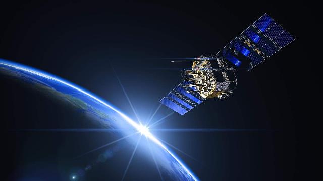
Which countries have their own global positioning systems
The club of owners of their own satellite positioning systems is small. Today, there are four global systems in the world: American (GPS), Russian (GLONASS), European (Galileo) and Chinese (BeiDou). And two regional ones — Indian and Japanese.

GLONASS — Global Navigation Satellite System
Image source: Photo: Roscosmos
The Indian IRNSS/NavIC system — Navigation with Indian Constellation — includes seven satellites in geostationary and geosynchronous orbits and allows the military to obtain coordinates in the Indo-Asian region. By the way, the motive for creating India's own navigation system was the blocking of the United States from obtaining accurate GPS coordinates in the region during the Indo-Pakistani conflict in 1999.
Four satellites make up the Japanese QZSS (Quasi-Zenith Satellite System) system today. Working on the western Pacific Ocean, the Japanese system complements global GPS.
And how did it all start and how did the positions of the leaders develop? The first navigation systems in the USA and the USSR appeared in the early 1960s - TRANSIT in America and Cyclone in the Soviet Union were designed to determine and refine the coordinates of ships in the oceans. In 1973, the GPS Global Positioning System program was launched in the USA. The first satellite for it was launched in 1978. The system was ready in 1993, when the group had 24 artificial Earth satellites.

GPS — Global Positioning System
Image source: Photo: Global Look Press/Friedrich Saurer
Today, the American GPS system operates in two modes — civilian (L1 C/A) with an accuracy of 3-5 m and military with a Block-III generation satellite with an accuracy of less than 1 m. It includes 31 satellites in six orbital planes. It is believed that GPS is the most common coordinate determination system today, and the chips of all devices produced by the global electronics industry work with it.
In second place is Russian GLONASS, which is used in Russia, the CIS countries and in many other regions, as support for this system is also available in a large proportion of manufactured devices for positioning on the ground. The deployment, as well as overseas, was conducted in the interests of the military and was launched in 1982. By 1995, the operational readiness stage had been reached, and both the Navy and the Air Force of the Russian Federation used it. A new stage in its work began in the 2000s, when the state regained interest in developing its own navigation system. Today, GLONASS includes 24 satellites in three orbital planes and several spare ones. Just like GPS, there are civilian and military modes of operation.
The European Galileo system became fully functional in 2019. It has several modes — conventional, commercial and military. In a typical system of 26 satellites, it probably gives the highest accuracy — about 1 m. The military and commercial regimes are, of course, even more precise.
The ground station of the global European satellite navigation system Galileo
Image source: Photo: TASS/Janne Kieselbach
China has been operating its own BeiDou system since 2020. It consists of 35 satellites in different orbits, including geostationary ones. In the native region and in the western Pacific Ocean, the system provides high accuracy in determining coordinates — less than 1 m — due to a larger number of satellites. Otherwise, this is the same system as GPS and GLONASS, and today it is also available not only to the Chinese military, but also to many civilian users of a huge number of household devices for determining coordinates on the ground.
All these systems are being improved. With the development of unmanned vehicles, the requirements for the accuracy of determining the coordinates of an object on the ground are increasing, since without this, it is impossible to entrust independent movement to automobile, sea, and even more so to air transport. Moreover, we are not talking about military systems, but rather about civilian drones — drones are beginning to transport goods, passengers, perform monitoring and various other tasks, and without advanced and accurate positioning systems, this becomes both dangerous and ineffective.
Of course, satellite coordinate systems do not run out of options for the military. Systems based on completely different principles can be created, and, for example, experimental work is underway in Australia on a coordinate determination system that uses fixing the position of a terminal on the planet using quantum sensors that "sense" the Earth's magnetic field. Preliminary calculations show that the accuracy of such a system can be higher than that of satellite systems, and this is extremely important for the military.

Photo: Roscosmos
Image source: iz.ru
In addition, it is possible to use dual-purpose satellite groupings such as Starlink. Due to the large number of satellites with known coordinates, such systems can also be used to determine the coordinates of each specific terminal. For example, in terms of signal strength up to several satellite systems. Navigation on cell towers works in much the same way. It may also be of interest to the military to obtain an alternative way of navigation and in case GPS signals are jammed in a particular area. But nowadays it's possible.
The Russian GLONASS system is also developing — in 2030, in addition to the main part of the satellite constellation, it is planned to deploy a new segment with 240 low-orbit satellites. The height of the orbit of its new part will be 800 km, and such a segment will significantly improve the accuracy and stability of the global system, and ensure guaranteed satellite signal power. And again, not only for military, but also for civilian use — for unmanned vehicles, for smartphones and any other devices that need to receive information about coordinates and exact time.
Dmitry Kornev
